Inside Brief
- Researchers at the University of Minnesota Twin Cities have developed AI-powered aerial robots to track and analyze wildfire smoke plumes, offering a cost-effective, high-resolution alternative to satellites for air quality forecasting and hazard response.
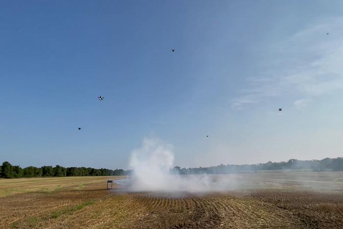
- The drone swarms capture multi-angle views to create 3D models of smoke plumes, addressing long-standing challenges in accurately modeling smoke particle dispersion from wildfires and prescribed burns.
- Beyond wildfires, the technology could be adapted for monitoring volcanic eruptions, sandstorms, and other airborne hazards, with future development focused on early detection, particle characterization, and extended-range surveillance using fixed-wing VTOL drones.
Researchers at the University of Minnesota Twin Cities have developed artificial intelligence-powered aerial robots to better track and analyze wildfire smoke plumes, aiming to improve air quality forecasts and hazard response. The study, published in Science of the Total Environment, demonstrates how drone swarms can provide a cost-effective, high-resolution alternative to satellites for monitoring airborne hazards.
According to the University of Minnesota, the work addresses longstanding limitations in smoke modeling, where existing tools struggled to capture the behavior and spread of smoke particles during wildfires and prescribed burns. Reserchers noted that according to a 2024 Associated Press report, prescribed burns caused 43 wildfires between 2012 and 2021.
The Minnesota team’s aerial robots use onboard AI to identify and enter smoke plumes, capturing multi-angle views that can be reconstructed into three-dimensional models. This allows for detailed analysis of smoke flow patterns and particle dispersion. Smaller particles, the researchers note, can remain suspended longer and travel farther, posing risks to regions far from a fire.
“This approach allows for high-resolution data collection across large areas—at a lower cost than satellite-based tools,” said Nikil Nrishnakumar, a graduate research assistant with the Minnesota Robotics Institute at the University of Minnesota and first author of the paper. “It provides critical data for improving simulations and informing hazard response.”
Beyond wildfire management, the technology could be adapted to monitor other airborne hazards such as volcanic eruptions and sandstorms, according to the researchers. The team’s next phase involves developing practical early detection and mitigation tools, where speed of response is critical. Previous work by the group included autonomous drones with real-time smoke tracking. The new system builds on this by incorporating Digital Inline Holography for particle characterization and using coordinated multi-drone formations. Researchers are also integrating fixed-wing VTOL drones, capable of long-duration flights without runways, to expand surveillance range.
The project team includes Jiarong Hong, professor of mechanical engineering and senior author; graduate researchers Nrishnakumar, Shashank Sharma, and Srijan Kumar Pal from the Minnesota Robotics Institute. The work was supported by the National Science Foundation’s Major Research Instrumentation program, with facilities provided by the St. Anthony Falls Laboratory.